Data collectors are at the heart of everything we do at Collect Earth Online (CEO). Their work powers national forest monitoring systems (NFMS), REDD+ programs, restoration assessments, and emerging mechanisms like the TFFF. The faster and more consistently data can be collected, the stronger the resulting information.
But data collection can sometimes involve frequent “context switching” — jumping back and forth between plots that look nothing alike, slowing down interpretation and making the process more mentally demanding.
A new optional feature in CEO is designed to help with exactly that.
The Plot Similarity Assistant uses GeoAI to identify which plots in a project are most similar to one another. With this information, data collectors can move through plots in a more streamlined, intuitive sequence instead of the default numeric order. This can help:
This tool is optional and works best in visually diverse landscapes, or in projects where collectors want a smoother, more intuitive workflow.
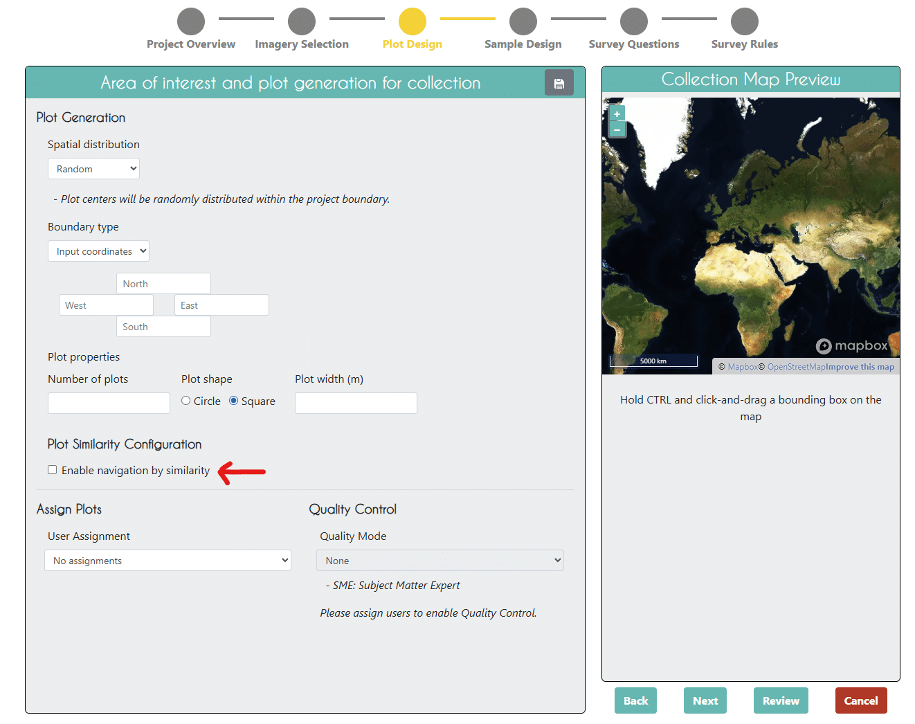
Project administrators can enable the feature during project setup by selecting “Enable navigation by similarity”, then choosing which plot to use as the reference plot and which year to use as a baseline.
Once enabled:
There is no change to project setup, sampling design, or question structure — only a smarter way to move between plots.
The Plot Similarity Assistant uses the Google Satellite Embeddings (GSE) dataset, which provides 10-meter resolution embeddings representing millions of features extracted from satellite imagery. These embeddings capture visual and spectral similarities that aren’t obvious from raw imagery alone.
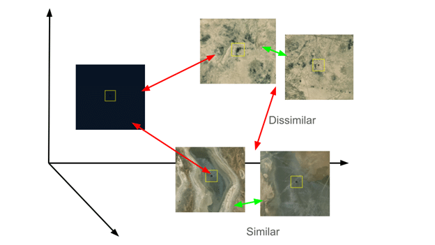
Here’s what happens behind the scenes:
The result is a smooth, GeoAI-powered experience that guides users through visually coherent sets of plots.
The Plot Similarity Assistant is just the beginning of what GeoAI can bring to CEO. We want your feedback as we continue adding new tools that support high-quality, transparent image interpretation.
Share your ideas with us or complete this 3-question survey to let us know!