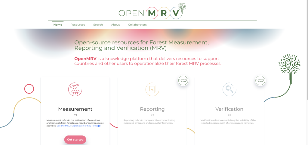
The Global Forest Observation Initiative (GFOI), together with its lead partner the World Bank, has launched the knowledge platform OpenMRV (openmrv.org). OpenMRV is an open-source, central repository for user-friendly measurement, reporting, and verification (MRV) support resources and instructional materials.
What is OpenMRV? Watch the 20-second promotional video.
As part of international climate change commitments, countries must develop MRV systems to estimate greenhouse gas emissions related to deforestation and forest degradation. This process can be challenging because each country must develop a system tailored to its unique circumstances.
In response, GFOI and the World Bank worked to create OpenMRV, a website that gathers a wide variety of MRV support resources. The goal is to enable countries to develop and implement their own MRV processes without external support.
As a critical tool supporting the MRV process for forest-related emissions, CEO has a central role in OpenMRV, which includes training documents on how to use CEO for collecting reference and validation data for MRV processes.
✔ Improving MRV
To participate in REDD+ programs, countries must develop strategies to reduce emissions from deforestation and forest degradation, promote sustainable forest management, and boost forest carbon stocks.
After implementing these strategies, they use MRV processes to verify that emissions have been reduced. After this verification, countries can receive payments for their emissions reductions. Countries thus have an incentive to create effective MRV systems.
These MRV systems rely on a combination of remote sensing and field observations. It can be difficult, however, for countries to learn what remote sensing tools are available and to follow best practices in developing MRV procedures.
That’s because there is little widely available guidance for using geospatial tools and implementing MRV. Most countries have to rely on external support for such guidance, which is dependent on donor funding that is not always available.
OpenMRV fills the gap in two key ways: first, by collecting existing MRV resources to facilitate information-sharing among participating countries; and second, by developing new training resources that help countries use geospatial tools to develop MRV processes.
With these resources available, countries can develop MRV processes even without donor support.
The OpenMRV website has resources available for supporting measurement processes, with reporting and verification resources due to be released soon.
Sharing existing resources
Dozens of countries are developing MRV processes, but they rarely share information with each other. Such exchanges are rarely promoted, and they can involve complex logistics. As a result, countries often are forced to reinvent the wheel—creating from scratch processes that other countries have already developed.
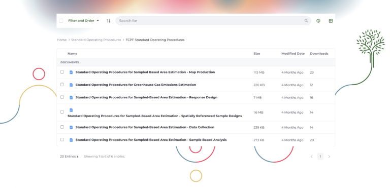
OpenMRV provides a better way. The web portal makes available actual MRV resources developed by several countries, such as standard operating procedures used to conduct national forest inventories.
The OpenMRV website provides a resource for countries to share resources, such as standard operating procedures.
OpenMRV hosts quality assurance and quality control (QA/QC) procedures and standard operating procedures (SOPs) for several topics, such as conducting area estimation and accuracy assessments. Generally, such documents are not available outside of the home country, a circumstance that prevents shared learning.
CEO featured among new support resources
OpenMRV also includes training materials and step-by-step instructions to help users accomplish critical MRV tasks.
CEO is included in a number of these key tasks. Through OpenMRV, countries can learn how to use CEO to:
Collect training data. Training data collected through CEO can be used to perform land cover and land use classification through cloud-based tools like SEPAL and Google Earth Engine (GEE).
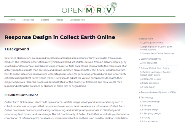
Collect reference (verification) data. After land cover and land use classification models are run, CEO can be used to collect reference data that informs the area and uncertainty estimates central to MRV processes, including for forest degradation.
CEO is featured in multiple training modules in OpenMRV, including collecting reference data in CEO.
In addition to the CEO resources, OpenMRV also includes useful guides for several other tasks, including:
Performing land cover/land use classification using SEPAL or GEE. These resources assist with performing land classification and change detection using the Continuous Change Detection and Classification (CCDC) algorithm in SEPAL; mapping deforestation and forest degradation using the Continuous Degradation Detection (CODED) methodology in GEE; and mapping land disturbances and recovery using LandTrendr in GEE.
Creating random sampling designs or random stratified sampling designs in SEPAL and GEE.
Creating sample-based area and uncertainty estimates (of forest, deforestation, forest degradation, or forest enhancement) using SEPAL or GEE.
The new resources developed for OpenMRV are available in English, Spanish, and French. Together, these resources provide the information countries need to develop and implement their MRV processes.
🧭An evolving resource
OpenMRV has been designed not as a static resource but as an adaptable tool that will evolve as technology advances and reporting requirements change.
If you are interested in using CEO to support your MRV processes, or are interested in learning more about OpenMRV, please visit www.openmrv.org.
CEO would like to thank its ongoing funders: FAO, NASA–USAID SERVIR, and SilvaCarbon, a US government program. Thanks also to CEO’s technology partners: Norway’s International Climate & Forests Initiative for funding open high-resolution data availability; Planet for providing high-resolution imagery; and the Google Earth Engine team for creating a platform for Earth science data and analysis.
Collect Earth Online is working constantly to improve the user experience, and your feedback is invaluable. If you have ideas to share, please write to support@collect.earth.