Data collection projects rarely stay static. As objectives evolve, teams often realize they need additional questions or new plots—sometimes after a project is already live and data collection is underway. To better support these real-world workflows, Collect Earth Online (CEO) now allows users to add new survey questions and plots to active published projects.
This update gives project managers more flexibility while preserving the integrity of previously collected data.
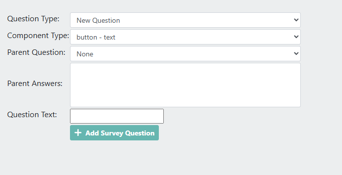
If you have an active project that already contains collected data, you can now extend the survey by adding new questions at any time. From the Edit Project option, navigate to the Survey Questions step in the Project Wizard and follow the same workflow used during initial project creation. This includes support for all question types, as well as child (nested) questions.
This capability is particularly useful when project requirements expand midstream—for example, when new reporting needs arise or when additional attributes become relevant after initial data review.
It is important to note that when survey questions are added to an active project, Collect Earth Online does not currently recalculate project completion percentages. If all original plots were completed prior to the update, the project will continue to display as 100% complete, even though new questions have been introduced.
For more substantial changes, such as redesigning the survey structure or plot design entirely, users may prefer to duplicate the project and start a revised version.
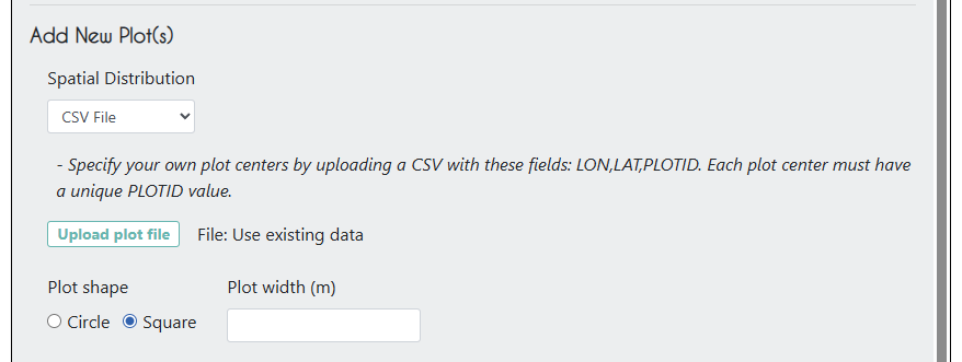
In addition to updating survey questions, users can also add plots to a project by uploading additional plots as a new file. This option is ideal when data collection needs to focus on a specific location or when plots must align with externally defined boundaries. Collect Earth Online supports plot uploads using CSV, Shapefile, or GeoJSON formats.
Simply edit the project, navigate to Plot Design, and upload your new plot file under the Add New Plot(s) heading. Once uploaded, users can finalize plot details directly in the Plot Generation step, including specifying plot shape and diameter for CSV-based plots.
These updates are designed to support the way monitoring and assessment projects actually work—iterative, adaptive, and responsive to new information. By enabling controlled updates to active projects, Collect Earth Online helps teams remain flexible without sacrificing transparency or data quality.
As always, we encourage users to consider how mid-project changes may affect analysis and reporting, and to document decisions accordingly.